blah blah blah
Stub Hill Pond
Length: 5.2 miles out-and-backDifficulty (click for info): Easy
Elevation Gain: 1000 feet (+100 feet on return)
Rating (click for info): 6/10
Elevation: 3480'
Driving Directions:
Trailhead is on a spur of Smith Brook Road in Pittsburg, NH. From Rt. 3, 11.6 miles north of Rt. 145, turn east onto a logging road called Magalloway Road. There is no sign for the road, but the entrance is very wide and there is a marker for the Magalloway lookout tower. Drive in 1.2 miles on Magalloway Road. Immediately after crossing the bridge over the Connecticut River, turn left onto Smith Brook Road at a kiosk. Go 1.6 miles down this road and bear left at the fork. Continue another 0.7 miles and stay right at the junction, then pass through a cluster of cabins as the road turns left. Go another 0.4 miles and turn right onto an unnamed road at a junction with a kiosk. This is where the drive gets a bit steep and rough. Ordinary cars will have no trouble driving the solid dirt roads up to this point, but beyond here, smaller vehicles will not do as well. Continue 1.65 miles up this road, and turn left onto a less travelled road at a junction with another kiosk and a sign pointing to a scenic view straight ahead. In 0.95 miles, you will reach a fork. You will need to take the left (main) fork to get to Stub Hill. There are a few places to park here. Our directions for the hike start at this fork, but it may be possible to drive further up the road. Click here for a Google map.
About the Hike:
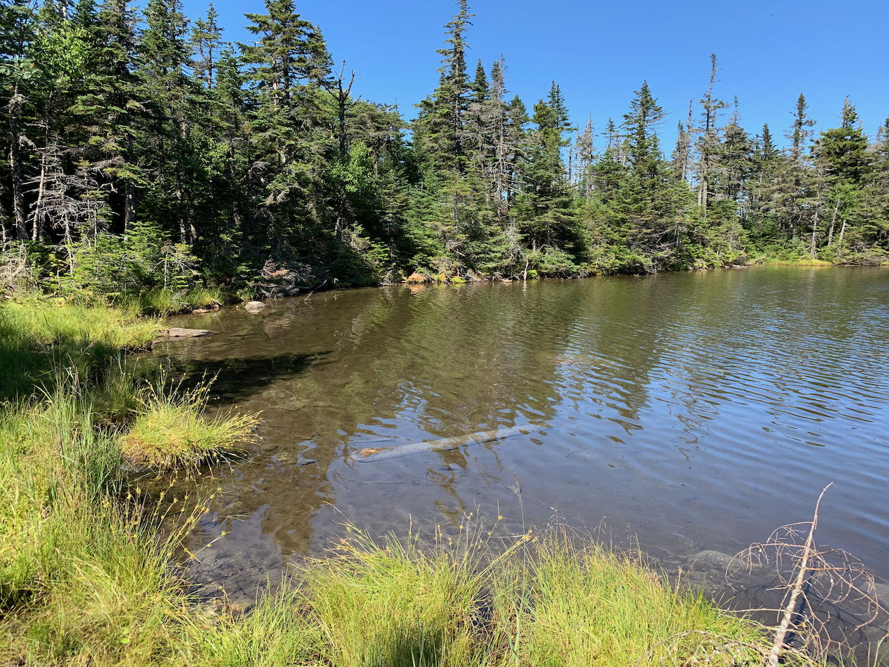
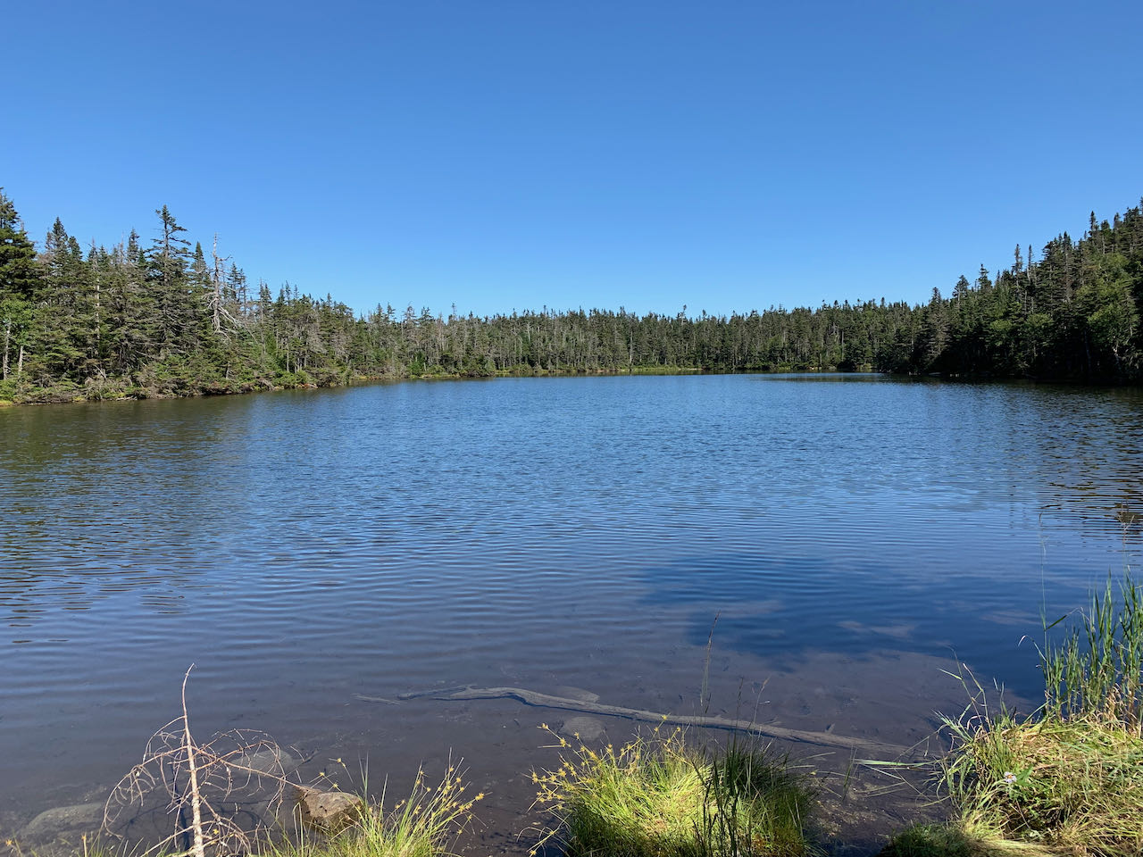
Stub Hill Pond is easily one of the most remote locations in all of New Hampshire. Access is via a long driving approach on logging roads which can be hindering to low-clearance vehicles, followed by an easy hike up the road and on an unofficial fisherman's trail. Very few hikers will be willing to put in this much effort to visit this highly isolated locale, but this is part of what makes it so attractive. Also contributing to the pond's mystique is its high elevation (nearly 3500') and proximity to the summit of Stub Hill, highest mountain in Pittsburg and the Connecticut Lakes-Dixville Notch region of the north country. This tiny waterbody is tucked away on a small shelf, surrounded by the lush evergreen forest that is so prevalent in the great Magalloway logging wilderness. Just being on a hike in this secluded of an area can be appealing.
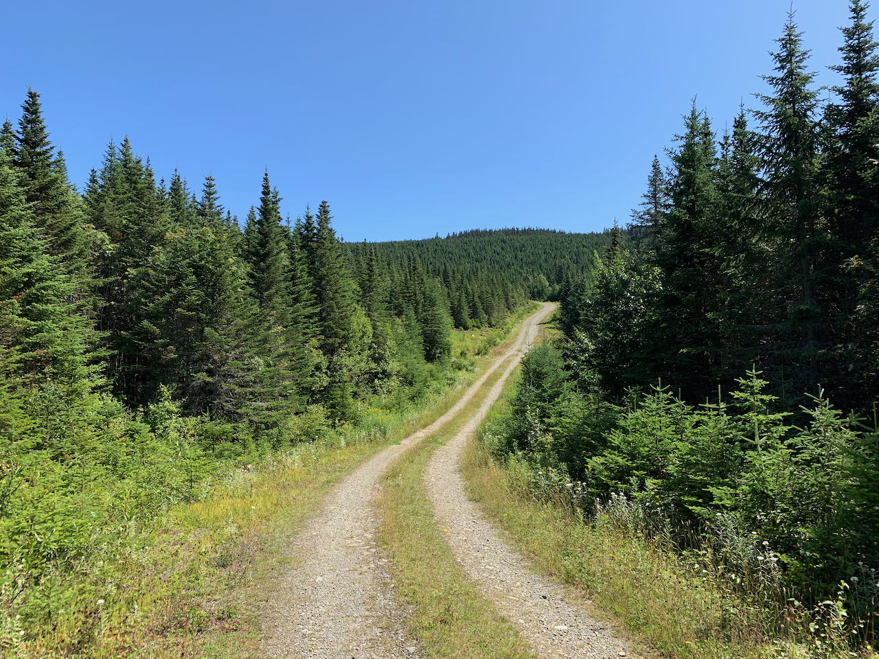
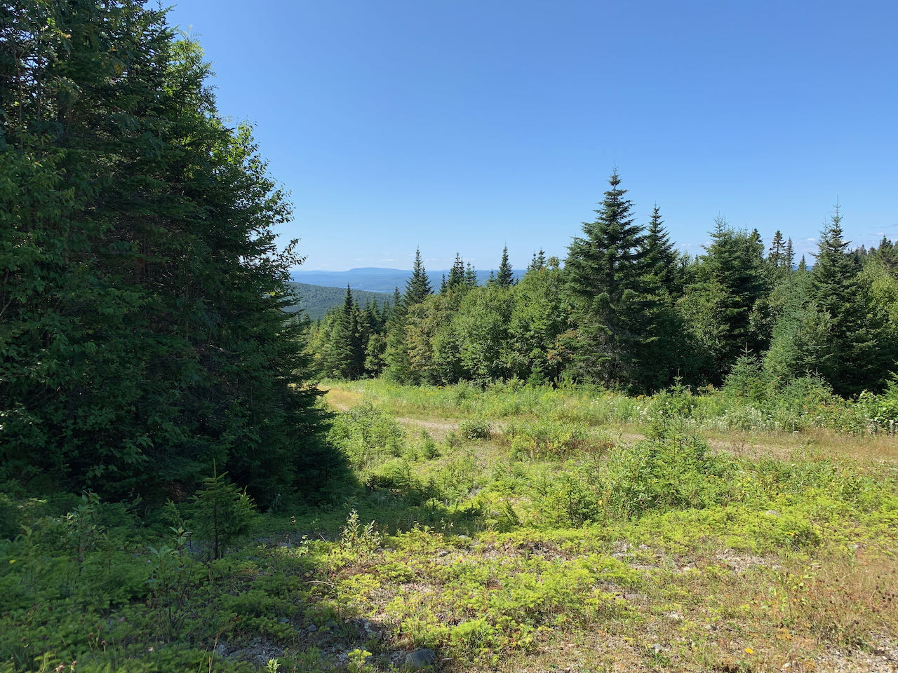
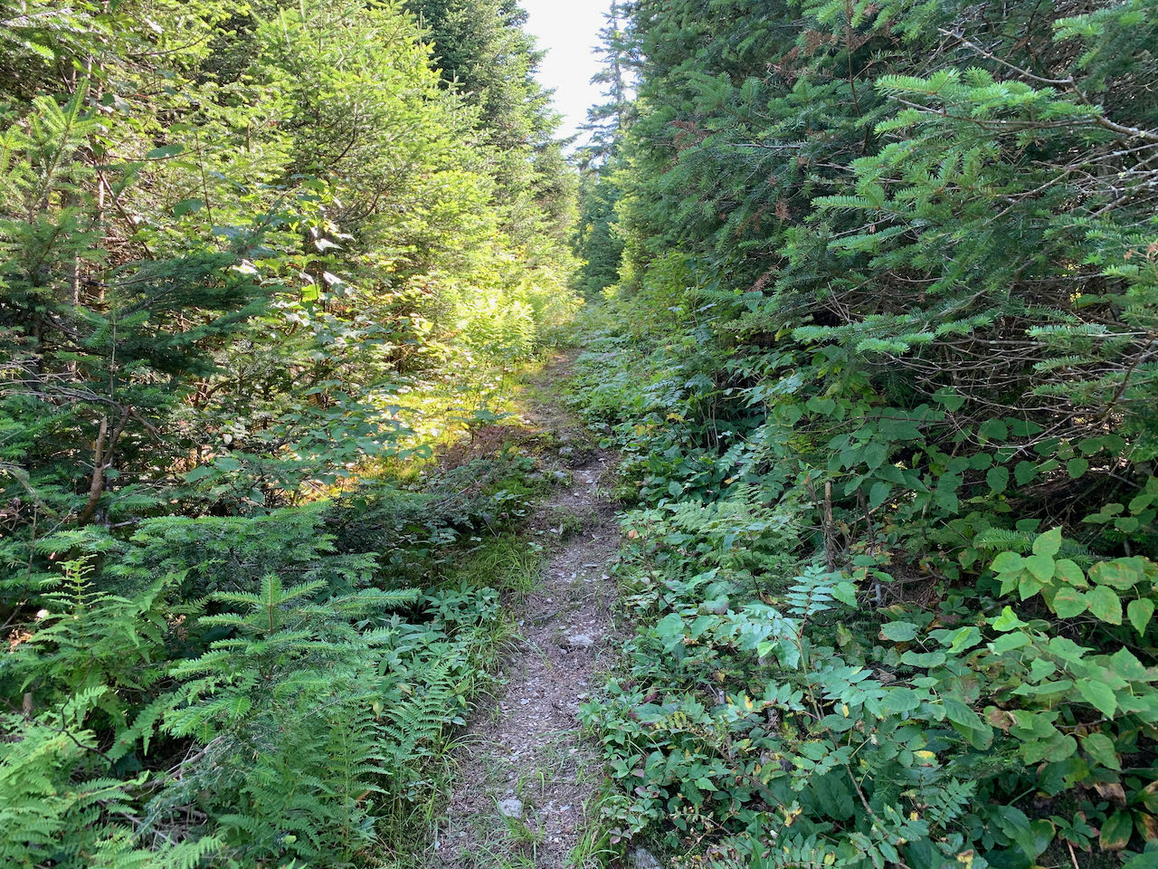
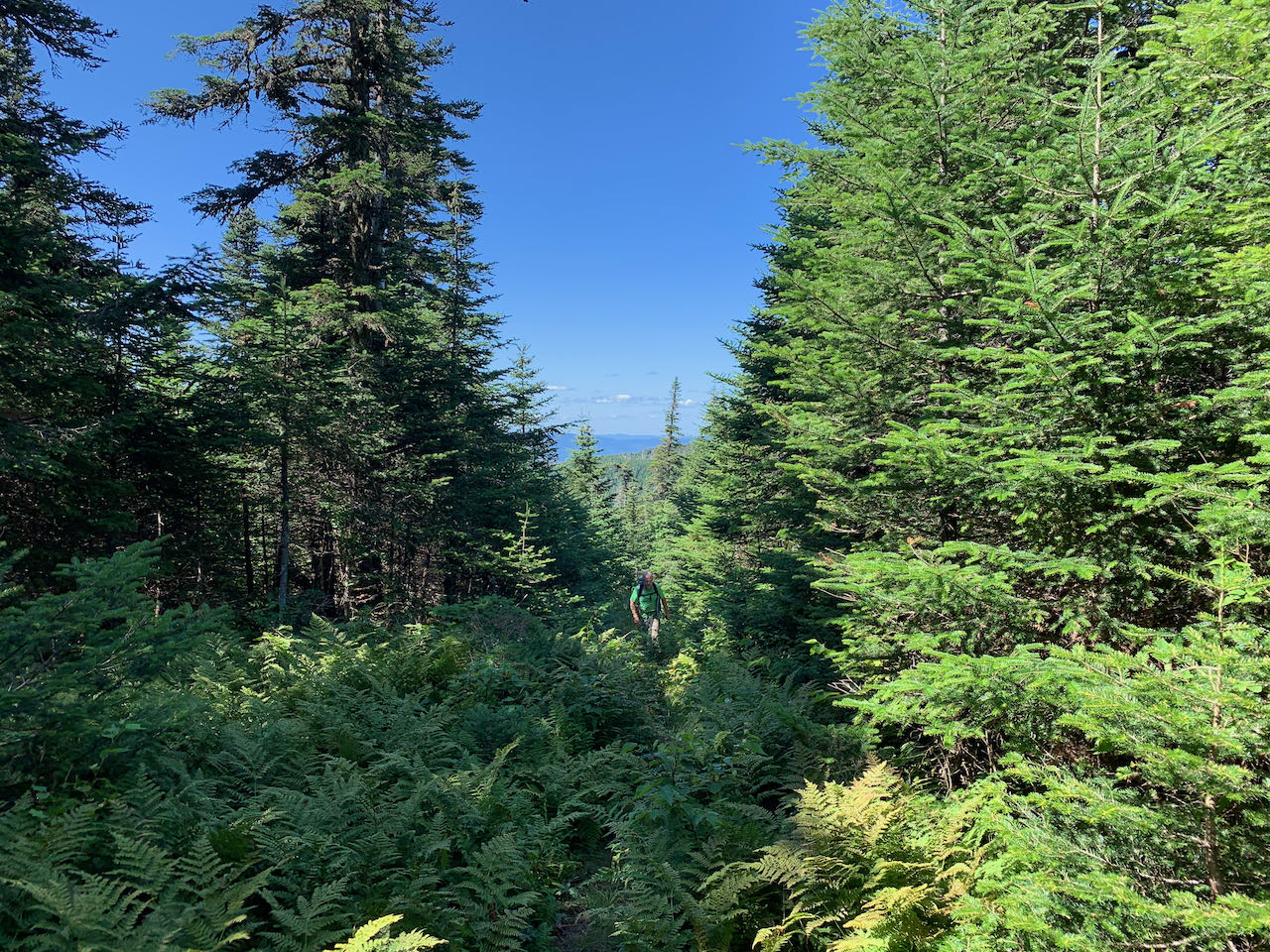
From your pull-off at the fork, start your hike up the left fork of the road on foot (or continue from wherever you drove to). The road ascends easily over some washed-out areas that would be difficult to drive. At first pointing away from your destination, at 0.6 miles from the fork, the road reaches its furthest point away from Stub Hill in a large 180-degree turn, reversing direction. In another quarter mile, it begins a gradual 80-foot descent, followed by a shorter 20-foot drop, after which it climbs again, curving around the slope. After swinging around to head toward the col between Stub Hill and its north peak, a spur road is passed on the right at 1.7 miles from the start. The road swings left again, and ascends; in this section, look behind you as you walk for some nice mountain views. The height-of-land in the col is reached in another 0.35 miles. As the trail levels off, look for a grassy clearing leading into the woods on the right just beyond the highest point. Watch carefully for the break in the trees where the fisherman's path begins. There are no markings, but once you locate it, it is easy to follow for the remainder of the hike. The trail corridor is quite wide, but the footway is just a herd path. It's a nice forest path with some moderate to steep inclines. Hike up 0.4 miles through the enchanting northern forest, and the trail flattens out and starts to descend toward the pond. At its highest point, the trail is only about 1000 feet from the summit of Stub Hill, through dense and tall ferns. Those familiar with off-trail navigation can find some nice views from the summit opened up by blowdowns, where one can see out to the Rangeley High Peaks in Maine. The trail descends slightly for the last 0.1 miles to the pond. The section of the path near the shore splits into a couple forks and can be muddy at times. It is a quiet, pretty tarn that appears very shallow, and may have an old boat on the shore. Enjoy your time taking in the solitude of this high-altitude pond.
Printable directions page